
Planimeter - GPS area measure | land survey on map
Chơi trên PC với BlueStacks - Nền tảng chơi game Android, được hơn 500 triệu game thủ tin tưởng.
Trang đã được sửa đổi vào: 9 tháng 7, 2018
Play Planimeter - GPS area measure | land survey on map on PC
Check out Free Planimeter Guide with details about how to determine square footage and all other features: http://goo.gl/J7iZIn
Features you won't find in other apps:
- live auto map measure using GPS tracking (walk / drive around boundary) with time interval and accuracy settings;
- magnifying glass for very accurate pin placement for distance and area measure: https://youtu.be/Hha_nmC032M
- add point with exact distance and angle input (Distance and Bearing Feature): http://goo.gl/8XbhJU
- create, share and view KML directly from e-mail attachment , file browser, etc: http://goo.gl/2cdI8w
- intuitive and friendly way to add labels in Notes Mode (extra paid mode): http://goo.gl/s52VdU
- quick share, directions and navigation to selected point is available from Notes Mode (extra paid mode): http://goo.gl/nCRTQi
- smart features to remove redundant points and generate convex areas;
- different geo-coordinate formats;
- quick switch and view measured path and polygons in pre-cached Google Earth app (extra paid feature);
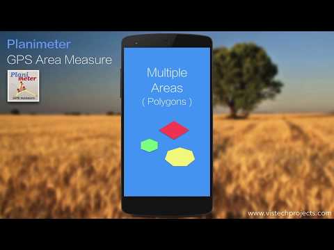
- Multiple areas measurements (in-app purchase): https://goo.gl/SrFMj3
- Circle Mode (in-app purchase) - radius around point https://goo.gl/dkHuvy
- Volume / Cost calculator when height or rate per area unit entered https://goo.gl/dkHuvy
Multilingual: English, Portuguese, Russian, German
The app has many positive comments from users and has been successfully used in different areas:
- outdoor activities: sports, golf (distance between two points or holes), bike tours, trail planning, travelling, quick path measure , map your run
- garden and yard: landscape planning, grass cutting, lawn care and mowing, fencing, grass seeding.
- agriculture, poultry and farming: harvesting, fertilizing, crops (corn, wheat, maize, beet, etc.) planning and estimation, crop fields labeling for the records, field area measure, paddocks and area fencing for cows, horses, chickens, rabbits, etc.
- solar energy: area estimation for solar panels, flat roof area estimation
- construction: land survey, road sealing, parking lot repairing
- forestry: objects and tree mapping, damage area estimation, measure land area
- other: ponds size and are measure; pole lines planning; directions and navigation to the marked / shared point; movement tracking; get exact GPS coordinates of way-points; fence calculation; measure distance on google map, geocaching.
More about the app, tips and updates: https://vistechprojects.blogspot.com/search/label/Planimeter
Chơi Planimeter - GPS area measure | land survey on map trên PC. Rất dễ để bắt đầu
-
Tải và cài đặt BlueStacks trên máy của bạn
-
Hoàn tất đăng nhập vào Google để đến PlayStore, hoặc thực hiện sau
-
Tìm Planimeter - GPS area measure | land survey on map trên thanh tìm kiếm ở góc phải màn hình
-
Nhấn vào để cài đặt Planimeter - GPS area measure | land survey on map trong danh sách kết quả tìm kiếm
-
Hoàn tất đăng nhập Google (nếu bạn chưa làm bước 2) để cài đặt Planimeter - GPS area measure | land survey on map
-
Nhấn vào icon Planimeter - GPS area measure | land survey on map tại màn hình chính để bắt đầu chơi
